Land Cover
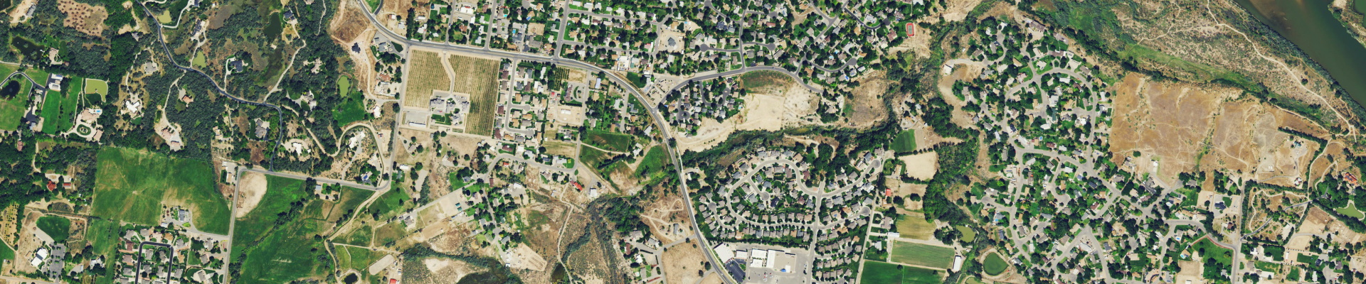
EarthDefine's US Land Cover on demand product provides high-resolution land cover mapping for any area in the contiguous United States. Our propreitary AI can deliver over 95% accurate high-resolution (60 cm) land cover data typically within days of placing an order. We can also provide a historical snapshot of land cover by classifying older aerial imagery from our data archive.
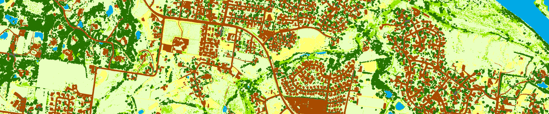
Use the slider below to swipe between the the US Land Cover Map and the imagery from which it was extracted
Classes
| Class Name | Value | Classification Description |
|---|---|---|
| Herbaceous | 1 | all surfaces with non-woody vegetation - lawns, cropland, grasses, etc. |
| Bare | 2 | non-vegetated non-impervious cover - snow, sand, barren farmland, rock, etc. |
| Impervious | 3 | impermeable built-up surfaces - roads and transportation infrastructure, sidewalks, buildings, parking lots, etc. |
| Water | 4 | open water - lakes, rivers, streams, sea, ponds, etc. |
| Trees | 5 | trees |
| Shrubs | 6 | low woody vegetation - early stage or stunted trees |
| Trees over Impervious | 7 | tree canopy covering built-up surfaces |
How is this data created?
EarthDefine has leveraged advancements in computer vision and AI to address complex geospatial classification challenges. We have developed robust AI models for extracting different ground cover types. These AI models are deployed on high-resolution color infrared imagery to create the US Land Cover Map product.
How does it compare with existing datasets?
Coarser resolution land cover datasets are often used in projects that need analytics over a large area. However, low resolution data products can have a high degree of commission and ommission errors, especially in complex environments like urban areas. EarthDefine's data overcomes these limitations by precisely capturing even small variations in ground cover while enabling rapid extraction across large geographies.
Use the slider below to compare low resolution land cover with EarthDefine's high-resolution data
What can you do with the Land Cover data?
The Land Cover product helps local, state and federal agencies, companies and non-profits by supplying accurate and spatially explicit high-resolution land cover data for performing a wide range of mapping and analytical functions. Example applications include:
- measuring current and potential tree canopy coverage for Urban Tree Canopy (UTC) assessments
- understanding quantity/quality of stormwater runoff based on the distribution of impervious and other land cover
- improving line of sight radio wave propagation modeling for wireless planning through derivative 'clutter' classification
- conducting environmental impact assessments for construction projects
- monitoring land cover change related to oil and gas development
- finding the least-cost pathways for building utility corridors and highways
- predicting erosion risk through analysis of land cover and terrain data
- wildfire risk modeling and mitigating post fire ecological impacts
- monitoring urban growth
- using dasymetric mapping methods to improve surface population maps for risk vulnerability analysis related to natural disasters
- modeling carbon storage and change as a function of land cover types
Need more information?
Get StartedMetadata
Related Products
US Tree Map
Tree Locations
Canopy Height Model (CHM)
US Impervious Map
US Building Footprints
Latest Tweets @earthdefineLLC
Contact Us
8410 154th Avenue NE, Suite C-240
Redmond, WA 98052
Phone: 1.800.579.5916
Email: info@earthdefine.com
2021 © All Rights Reserved.