- 85%+ US at 50cm resolution
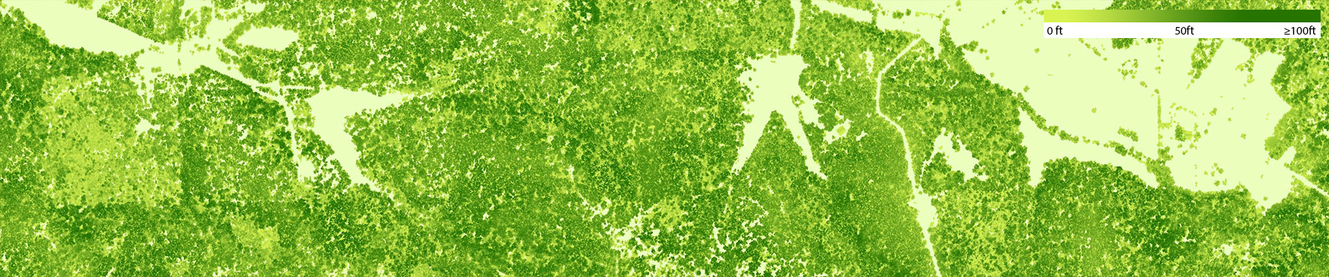
- Tree heights in feet
- Updated annually
The industry standard for tree canopy analysis
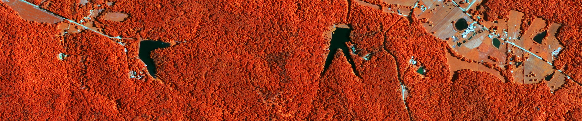
The Canopy Height Model (CHM) dataset is a high-resolution (50cm) raster layer that maps the tree height as a continuous surface. Each pixel in the CHM represents the tree overstory height above the underlying ground topography. The key data source for creating a CHM is LIDAR data. LIDAR (Light Detection and Ranging) technology enables accurate measurement of elevation for different ground surface types based on the light pulses reflected from the earth. LIDAR systems produce large volumes of 3D point cloud data which can be analyzed to map different surface types and their elevation. The accuracy and quality of a CHM improves with higher point density LIDAR data.
How industry leaders apply our Canopy Height Model
LIDAR canopy derivatives like the CHM dataset helps government agencies, companies and non-profits by supplying accurate and spatially explicit high-resolution tree canopy height data for performing a wide range of mapping and spatial analysis functions. Example applications include:
- evaluating tree shade for solar energy assessment
- assessing vegetation risk to power lines and other utility infrastructure
- modeling of forest metrics like tree size class, basal area, volume etc., in conjunction with suitable field data
- assessing fuel load and fire risk
- monitoring logging and forest recovery
- evaluating the condition of forests in recreational areas
- improving line of sight radio wave propagation modeling for wireless planning
- assessing habitat suitability for wildlife
- creating and analyzing forest inventory
- assessing accurate visibility in forested regions from ground surface points
- identifying locations of trees that may qualify for inclusion in a Big Tree Register
Our proprietary AI-powered methodology
EarthDefine combines LIDAR data with high-resolution imagery data to create the Canopy Height Model (CHM) dataset. A Digital Surface Model (DSM) is created from first returns of the LIDAR point cloud data. An above ground surface model is created by removing bare earth elevations from the DSM. Buildings and tree canopy are differentiated in the above ground surface model using a knowledge based classification system.
Related Products
Tree Map
Tree Locations
Land Cover
Impervious Map
Building Footprints
| Technical Specifications | |
|---|---|
| Resolution | 50cm |
| Height units | feet or meters |
| Minimum Mapping Unit | 0.005 acre |
Download and Evaluate
Looking for samples for a specific region?
Our data experts can generate a sample for your region of interest.
Request DataData coverage and freshness
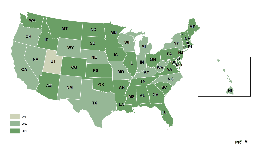
Derived from the latest NAIP acquisition cycle — the most current, consistent nationwide aerial imagery program available. Every dataset includes source imagery metadata so your predictions are reproducible and defensible.
2026 © All Rights Reserved.