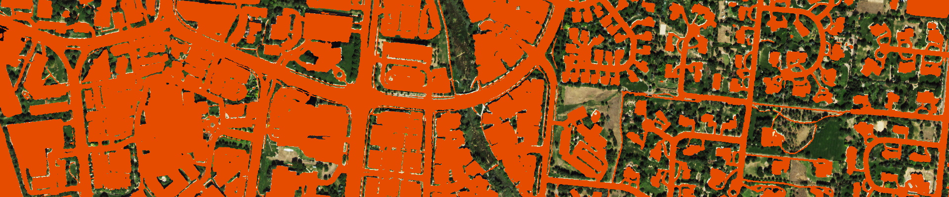
What is the US Impervious Map?
Accurate and updated data on built-up surfaces is critical for understanding the growth of urbanization and it's impact on the health of ecosystems. The US Impervious Map is the most detailed and up-to-date mapping of impervious surfaces across the contiguous United States. It provides information on the presence or absence of impervious features at 1-meter resolution, accurately capturing built-up surfaces like buildings, roads, sidewalks, parking lots, airports, etc. as a single impervious class. The data is refreshed annually to capture changes in the built environment.
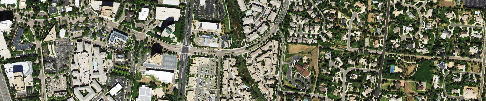
Use the slider below to swipe between the US Impervious Map and the imagery from which it was extracted
How is this data created?
EarthDefine has leveraged advancements in computer vision and AI to solve geospatial classification challenges. We developed a robust AI model that can consistently classify impervious cover in aerial imagery across the continental US. The AI model was used to classify over 120 terabytes of high-resolution color-infrared aerial imagery spanning over 3.1 million square miles to create the US Impervious Map.
How does it compare with existing datasets?
Currently, the National Land Cover Database (NLCD) is the only other nationwide impervious dataset. However, with a 30-meter pixel resolution and a 5-year update cycle, the NLCD impervious cover is not suitable for many kinds of geospatial analyses that require greater mapping precision and updated data. EarthDefine's US Impervious Map overcomes these limitations by classifying impervious cover at 900 times the spatial resolution and updating the data annually. This captures even small impervious features including driveways and sidewalks. Our propreitary AI classifies built-up surfaces even when they are partially obscured by tree cover or under shadows, so that road connectivity is mostly maintained and structures are accurately captured.
Use the slider below to compare NLCD with the US Impervious Map
How accurate is the US Impervious Map?
The US Impervious Map has an overall accuracy of 94.9% in census defined urban areas. Accuracy was assessed using 48,000 random points (1000 points/state).
Can the US Impervious Map be used for change analysis?
The US Impervious Map AI model can be employed to map impervious cover using aerial imagery from previous years. For most areas in the US, we have access to historical imagery starting from 2005. Using older aerial imagery multiple snapshots of impervious cover can be derived for change analysis.
How can I use this data?
High resolution impervious cover data is a key environmental indicator useful for multiple applications including:
- Calculating stormwater runoff volume, modeling water quality and flood risk
- Develop TMDL (Total Maximum Daily Load) using impervious cover as a surrogate for runoff pollutants
- Understanding urban heat islands
- Developing stormwater management plans
- Improving mapping of urban and rural populations through dasymetric mapping
- Assessing non-point source pollution and downstream water quality
- Assessing stream bank stability and streambed sedimentation
- Understanding relationships between different land-use types and imperviousness
Need more information?
Let's Talk DataMetadata
| Technical Specifications | |
|---|---|
| Resolution | 1 meter |
| Urban Areas Accuracy1 | 94.9% |
Download and Evaluate
Let's Talk Data
Contact Us
8410 154th Avenue NE, Suite C-240
Redmond, WA 98052
Phone: 1.800.579.5916
Email: info@earthdefine.com
2025 © All Rights Reserved.