- Nationwide coverage at 60cm resolution
- Maps woody vegetation
- Available off-the-shelf
Tree Map: the definitive tree dataset
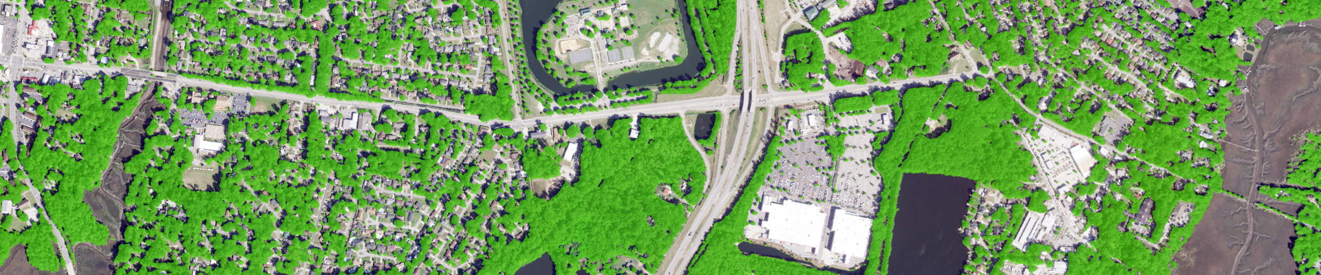
Accurate and updated tree cover data is critical for effectively managing our tree resources. Our Tree Map product is the most detailed and up-to-date source of tree cover data for the country. It provides information on presence/absence of trees at 60cm resolution, accurately capturing individual trees and small gaps in the forest. The data is refreshed annually to capture changes in tree cover due to deforestation, urbanization, land-use change and natural disasters.
Use the slider below to swipe between the Tree Map and the imagery from which it was extracted
EarthDefine's proprietary AI models
EarthDefine has leveraged advancements in computer vision and AI to solve geospatial classification challenges. We deploy a proprietary tree classification AI model on hundreds of terabytes of summer leaf-on imagery every year to create and update the Tree map.
Why industry leaders choose us
Currently, the National Land Cover Database (NLCD) tree canopy data layer provides nationwide tree canopy estimates. However, with a 30-meter pixel resolution and a 5-year update cycle, the NLCD tree cover is not suitable for many kinds of geospatial analyses that require greater mapping precision and updated data. EarthDefine Tree Map overcomes these limitations by classifying tree canopy at 2500 times the spatial resolution and updating the data annually. This captures even small individual trees besides accurately mapping the edges of forest patches.
Use the slider below to compare NLCD with the Tree Map
Proven accuracy that drives results
The Tree Map has an overall accuracy of 96.6%. In census defined urban areas the overall accuracy is higher at 97.3%. Accuracy was assessed using 48,000 random points (1000 points/state).
Custom analytics for your unique needs
EarthDefine has partnered with PlanIT Geo to deliver pre-analyzed tree cover data to help you easily plan and manage your urban forest. The TreePlotter Canopy data solution gives users an easy way to jump straight away into analysis without needing specialized GIS staff or software to work with raw tree cover data. The data solution also provides information on tree equity scores and ecosystem benefits besides easy to use interactive maps for community engagement. You can learn more about EarthDefine and PlanIT Geo's off the shelf data analytics solution here: TreePlotter Canopy.
Data coverage and freshness
Track changes over time with confidence
The Tree Map AI model can be employed to map tree canopy using aerial imagery from previous years. For most areas in the US, we have access to historical imagery starting from 2005. Using older aerial imagery multiple snapshots of tree cover can be derived for change analysis.
Plug into your workflow today
High-resolution tree canopy data is used for performing a wide range of mapping and analytical applications including:
- mapping actual and potential tree canopy in urban communities through Urban Tree Canopy (UTC) assessments
- assessing defensible space around buildings to reduce wildfire risk
- mapping risks to utility infrastructure like powerlines
- modeling of tree services like air and water pollution mitigation
- measuring carbon storage and sequestration
- wildfire modeling
- assessing tree risks to residential properties
- creating and analyzing forest inventory
- measuring agroforestry resources in rural landscapes
Related Products
Tree Locations
Canopy Height Model (CHM)
Land Cover
US Impervious Map
US Building Footprints
| Technical Specifications | |
|---|---|
| Resolution | 60cm |
| Overall Accuracy1 | 96.6% |
| Urban Areas Accuracy1 | 97.3% |
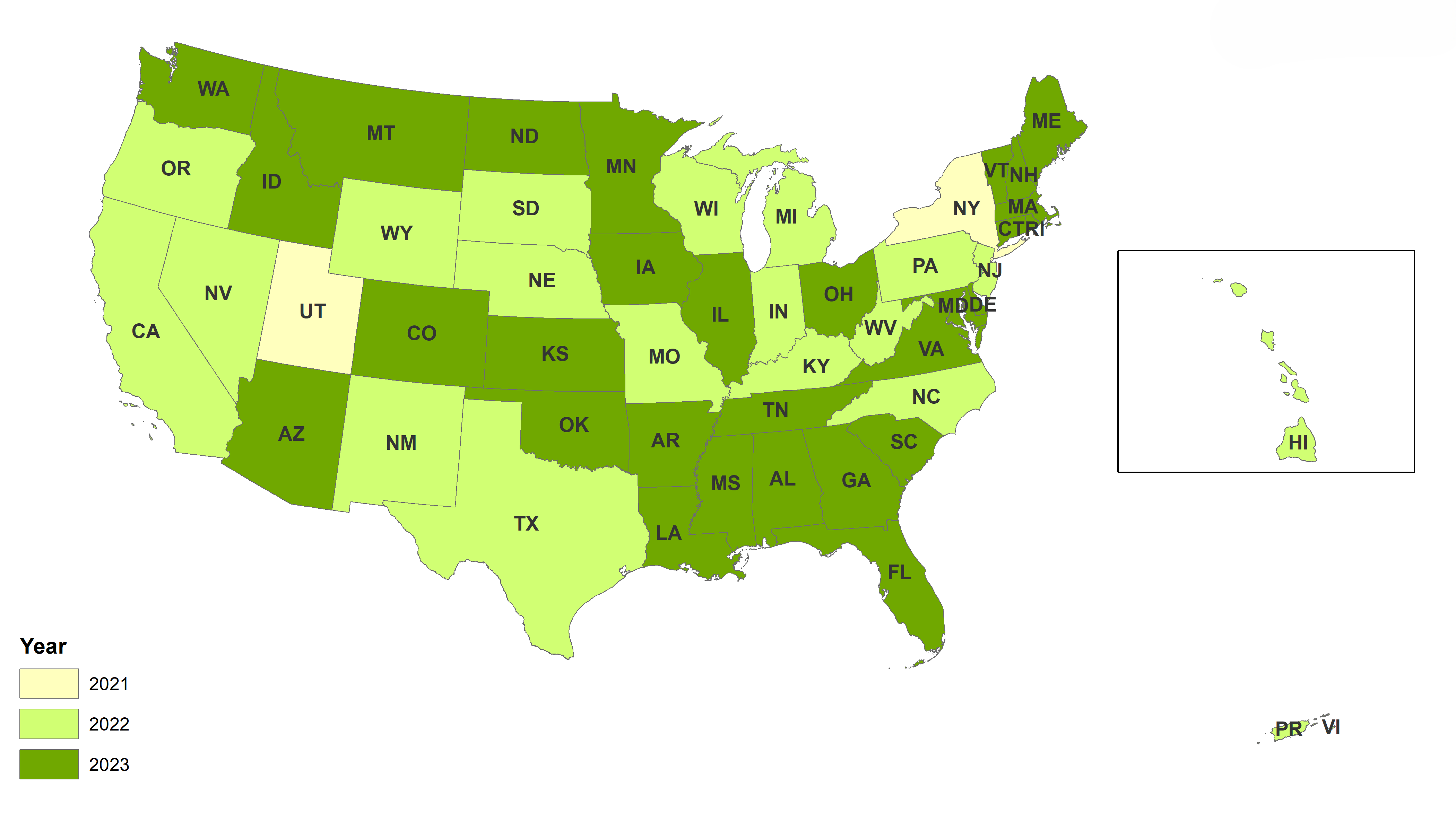
| Dates | 2021-2023 |
Download and Evaluate
Little Rock, AR
Grand Canyon National Park, AZ
Loyola, CA
Silverton, CO
Farmington, CT
Washington, DC
Dover, DE
Cape Coral, FL
Savannah, GA
Council Bluffs, IA
Stanley, ID
Chicago, IL
Fort Wayne, IN
Manhattan, KS
Pikeville, KY
New Orleans, LA
Boston, MA
Baltimore, MD
Portland, ME
Lansing, MI
Mississippi Headwaters, MN
St. Louis, MO
Gulfport, MS
Lewistown, MT
Asheville, NC
Bismarck, ND
Lincoln, NE
Nashua, NH
Newark, NJ
Taos Ski Valley, NM
Reno, NV
Ithaca, NY
Columbus, OH
Coweta, OK
Bend, OR
Conyngham, PA
Cumberland, RI
Hilton Head Island, SC
Mount Rushmore National Memorial, SD
Knoxville, TN
Austin, TX
Salt Lake City, UT
Chesapeake, VA
Burlington, VT
Redmond, WA
Madison, WI
Morganville, WV
Yellowstone National Park, WY
Looking for samples for a specific region?
Our data experts can generate a sample for your region of interest.
Request Data2025 © All Rights Reserved.