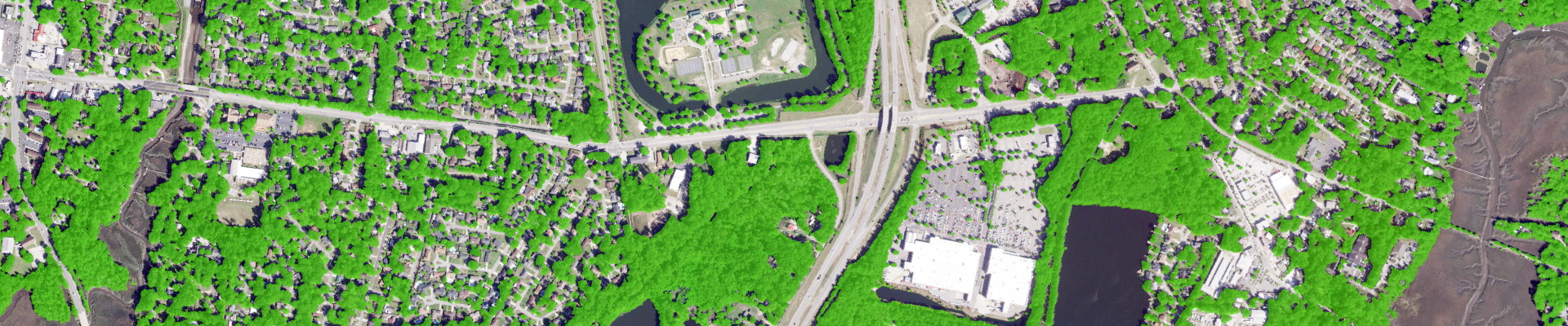
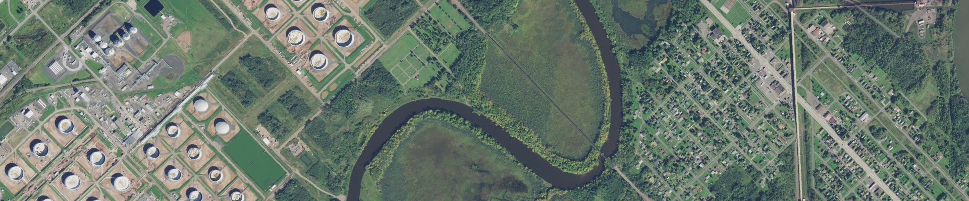
Tree Map
The nation's most precise tree cover intelligence at 60cm resolution: 2,500 times sharper than public data. Updated annually with 96.6% accuracy to power carbon accounting, urban forestry decisions, and environmental compliance when precision isn't optional.
Explore Tree Map
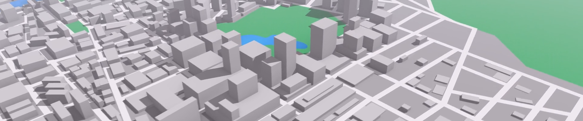
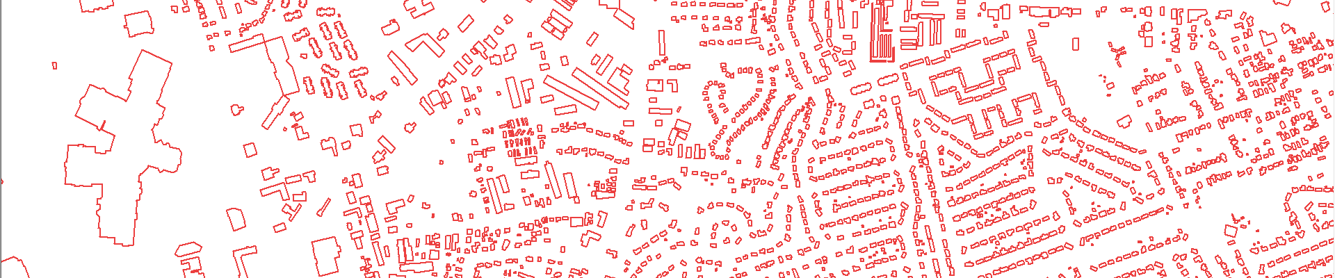
3D Building Footprints
Over 191 million structures mapped annually with 98% accuracy. The only continuously updated nationwide dataset delivering rooftop-precise geocoding, 3D attributes, and the building-level intelligence that street addresses can't provide.
Explore BuildingsLand Cover
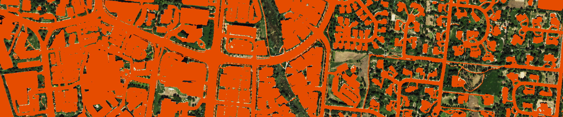
Seven-class mapping at 60cm resolution delivered on demand for anywhere in the U.S. Our AI captures ground truth variations invisible to coarser datasets: essential for stormwater compliance, habitat assessment, and environmental planning that passes regulatory scrutiny.
Explore Land Cover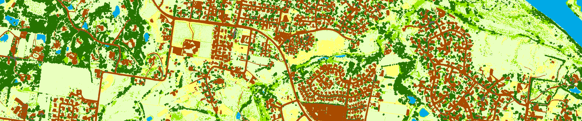
Impervious Map
Built-up surface mapping 2,500 times more detailed than federal alternatives. Our AI sees through tree cover and shadows to deliver the 60cm precision required for TMDL compliance, stormwater modeling, and urban growth analysis that stands up to engineering standards.
Explore ImperviousParking Lots
Nationwide parking infrastructure mapped with precision unavailable anywhere else. Purpose-built intelligence for retail site selection, commercial real estate valuation, and urban planning when parking capacity drives your decisions.
Explore Parking Lots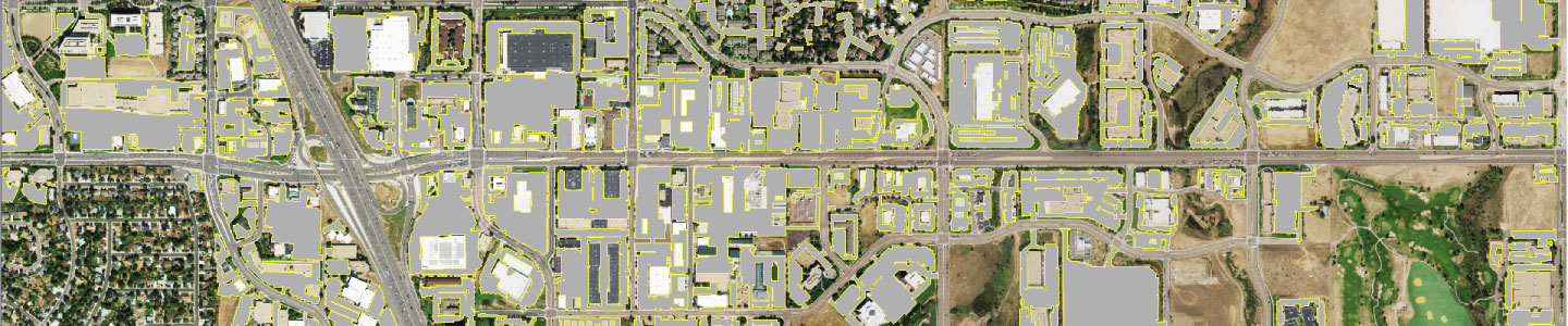
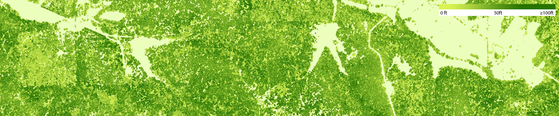
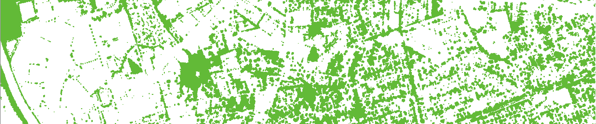
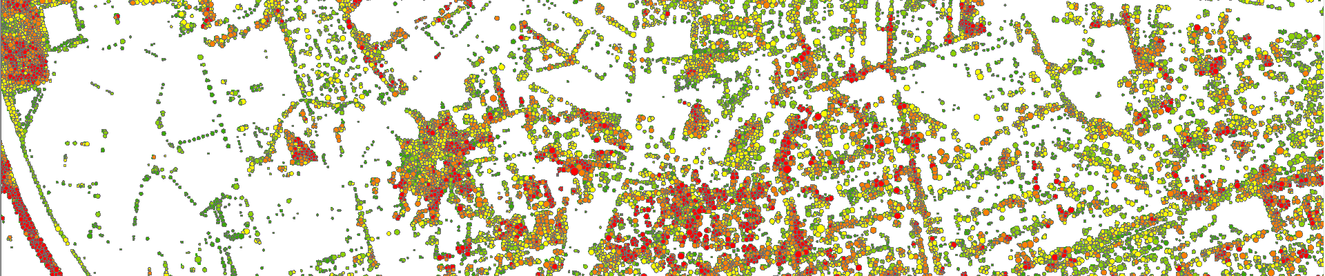
Canopy Height Model
LIDAR-derived tree heights at 50cm resolution with 90%+ accuracy. The vertical dimension essential for solar feasibility studies, RF planning, and forestry applications where approximate heights compromise your analysis.
Explore Canopy HeightsTree Locations
Individual trees mapped as points, polygons, and crowns with comprehensive attributes. Modeled tree locations for 3D urban modeling, powerline risk assessment and canopy management.
Explore Tree Locations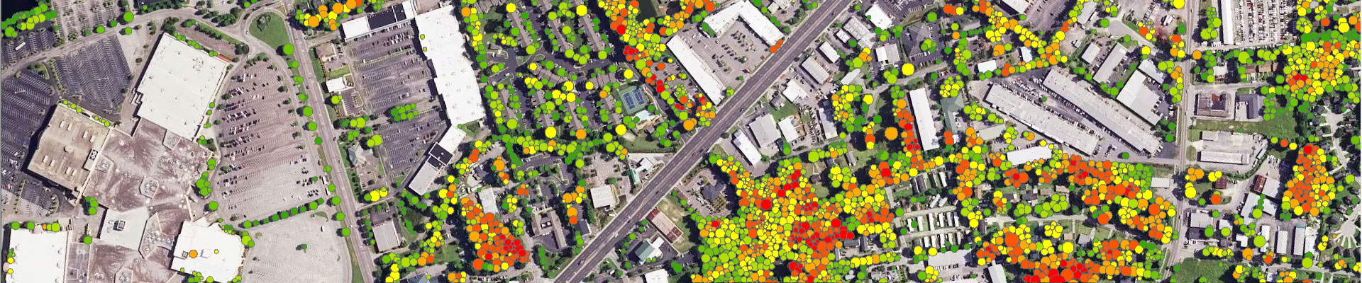
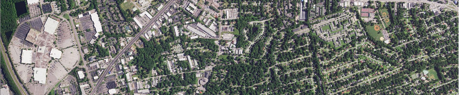
Experience the precision difference
Compare our high-resolution data with public alternatives.
The difference is striking.
Trusted by Leading Organizations
From federal agencies to Fortune 500 companies, organizations across the nation rely on EarthDefine's geospatial intelligence.
2025 © All Rights Reserved.