US Tree Map: EarthDefine Creates the Most Detailed Map of America's Trees
Oct 13, 2020
EarthDefine announces its US Tree Map: 550M+ acres of tree cover mapped at 900x the resolution of prior national datasets, using AI to process 120TB of aerial imagery.
PR Newswire
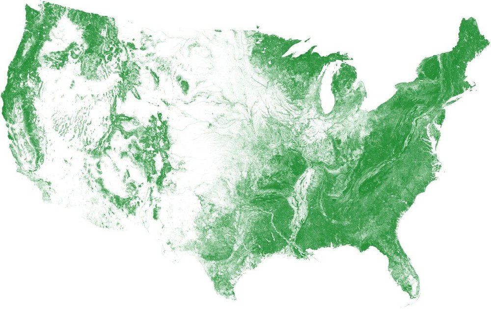
EarthDefine, a provider of high-resolution spatial data products, has released the first version of its US Tree Map product – accurately mapping over 550-million acres of tree cover across the conterminous United States. This data provides the most detailed mapping of the nation's tree cover by mapping trees at 900 times the resolution of currently available national datasets.
The US Tree Map seamlessly maps tree cover with an overall accuracy exceeding 96%. The data will be a continually updated to maintain a 'live' snapshot of the nation's trees. EarthDefine will acquire and process new aerial imagery every year, to keep track of the ever-changing tree cover in the U.S. at an unprecedented scale and precision.
EarthDefine used AI to process over 120 terabytes of 0.6-meter resolution National Agriculture Imagery Program (NAIP) aerial imagery to create the US Tree Map. The advantages of using such state-of-the-art AI is clear where trees need to be consistently classified across the vast and diverse geography of the continental US.