Biomass, Carbon Sequestration, and Avoided Emissions: Assessing the Role of Urban Trees in California
Jan 1, 2015
This collaborative report by UC Davis, the USDA Forest Service, and CAL FIRE assesses the current status of urban tree canopy and its benefits across California, while identifying communities most vulnerable to environmental threats and most likely to benefit from tree planting and maintenance.
UC Davis: Information Center for the Environment.
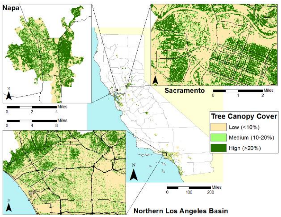
This report represents a collaborative effort between the Information Center for the Environment, Department of Environmental Science and Policy, University of California, Davis (UCD-ICE); the Urban Ecosystems and Social Dynamics Program, Pacific Southwest Research Station, USDA Forest Service (USFS-PSWRS); and the California Department of Forestry and Fire Protection, Fire and Resource Assessment Program (CAL FIRE-FRAP), to assess the current status of the tree canopy and associated benefits within the urban areas of California. In addition, the current status of environmental threats to the urban area population were also examined, in order to highlight the communities most vulnerable and potentially the most likely to benefit from tree plantings and maintenance.
Related products


Building Footprints 3D
193M+ properties mapped, with heights and elevations. Available off-the-shelf.
Learn more