From site-scale to landscape-scale: stormwater benefits of urban trees with SWMM-Canopy
Dec 16, 2025
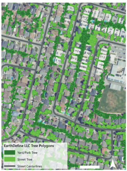
A new process-based tool, SWMM-Canopy, models how urban trees reduce stormwater runoff and, applied in a California case study, lets planners evaluate the hydrologic and economic performance of trees alongside green stormwater infrastructure.
Urban Water Journal
Abstract:
Urban trees can reduce stormwater runoff through canopy interception and enhanced infiltration, yet their benefits are often underrepresented in conventional models. This study introduces Storm Water Management Model-Canopy (SWMM-Canopy), a process-based tool that simulates diverse tree types and tree well designs to quantify stormwater runoff reduction. Sensitivity analyses highlight its flexibility across various conditions. To address key research gaps, limited tree hydrology representation and lack of integrated planning tools, we applied SWMM-Canopy with the GreenPlan-IT toolkit in a case study in California. The analysis quantified stormwater benefits from trees, scaled results from site to landscape, and compared the cost-effectiveness of trees and green stormwater infrastructure (GSI). SWMM-Canopy offers a practical approach for integrating urban trees into stormwater management, supporting multi-benefit planning and climate resilience. This work helps inform urban greening strategies and policy decisions by providing a flexible tool to evaluate the hydrologic and economic performance of trees alongside GSI.
Related products


Building Footprints 3D
193M+ properties mapped, with heights and elevations. Available off-the-shelf.
Learn more