EarthDefine Expands Property Information and Building Footprint Geocoding
Oct 20, 2020
EarthDefine expanded its AI database to over 156M US building footprints, giving insurers rooftop accuracy to better evaluate wildfire and weather risks.
PR Newswire
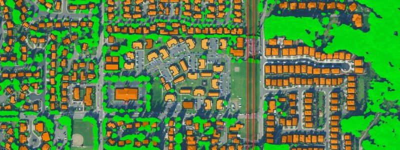
AI Startup EarthDefine Announces Expansion of its Building Footprint Geocoding and On-Demand Property Information
Source: PR Newswire
REDMOND, Wash., Oct. 20, 2020 /PRNewswire/ -- EarthDefine, a provider of high-resolution spatial data today announced the release of an updated building footprint database, which contains over 156 million footprints of commercial and residential structures across the continental United States. EarthDefine's latest update will allow insurers to identify with rooftop accuracy where structures fall within a parcel to improve risk rating, quoting accuracy, and claims response.
EarthDefine's building footprints are generated using state-of-the-art deep neural networks.
This AI-based approach is extremely accurate (98% accuracy) and allows EarthDefine to continually grow its building footprint database to provide an updated snapshot of commercial and residential properties throughout the continental US.
Related products

Building Footprints 3D
202M+ buildings mapped, with heights and elevations. Available off-the-shelf.
Learn more